Severe weather, snow flurries possible over weekend
Published 3:35 pm Friday, January 18, 2019
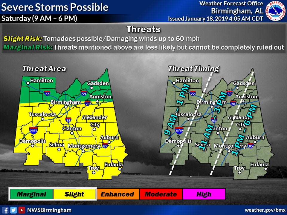
- There is a slight risk for severe weather on Saturday here in Chilton County. Temperatures are expected to drop into the mid-20s on Sunday night. (NATIONAL WEATHER SERVICE)
By J.R. TIDWELL / Editor
There will be a slight risk for severe weather across central Alabama on Saturday, Jan. 19, according to the National Weather Service in Birmingham.
Chilton County may get three quarters to an inch of rain on Saturday.
“The severe weather threat may begin around 9 a.m. Saturday in our western counties with additional strengthening expected as storms encounter a narrow axis of higher dewpoints near the I-65 corridor,” said the NWS in its weekend forecast. “Strong low-level and deep-layer shear will be supportive of damaging winds and several brief tornadoes if sufficient instability can develop. Again, this remains a highly conditional threat, contingent on instability being sufficient for deep convection.”
The potential for severe weather in Chilton County is expected to last from 11 a.m. to 3 p.m., with tornadoes possible and wind gusts of up to 60 mph.
“Strong to severe storms are possible through the day (on Saturday),” said Birmingham meteorologist James Spann. “Damaging winds and an isolated tornado are a threat. Stay aware of the weather on Saturday!”
According to the NWS, a cold front will enter the state after the weather rolls through with a “slight chance” of rain and snow showers.
“Cold air will pour into the region Saturday night as a cold front sweeps through,” said the organization. “Strong cold advection and steep low-level lapse rates may generate enough lift for light rain showers, which may transition to snow showers across our northern half in the midnight to 9 a.m. Sunday time frame. No impacts are expected at this time.”
Spann echoed the projection, saying “only flurries for Alabama late Saturday/early Sunday with no accumulation or impact.”
According to Spann, the skies will be clear Sunday night during a total lunar eclipse. It will begin at 8:36 p.m. and peak at 11:12 p.m.
“Bundle up, however, as temperatures will be below freezing,” Spann said.