Severe weather threat includes Chilton County
Published 2:52 pm Tuesday, April 29, 2014
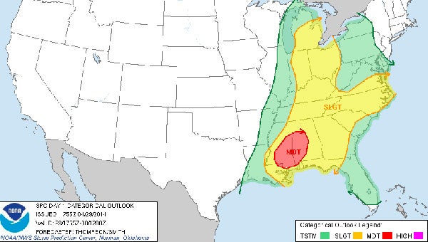
Although Chilton County missed the worst of the storms that hit parts of the state on Monday, another round of severe weather could affect the county through Wednesday morning.
Although Chilton County missed the worst of the storms that hit parts of the state on Monday, another round of severe weather could affect the county through Wednesday morning.
According to the National Weather Service in Calera, severe weather producing tornadoes, damaging winds, hail, heavy rain and flash flooding is expected to arrive after 6 p.m. Tuesday and last until about midnight.
Chilton County is under a flash flood watch through Wednesday morning with a precipitation forecast indicating there could be between 4-5 inches of rain throughout the county.
On Monday, Gov. Robert Bentley declared a State of Emergency for all Alabama counties as a result of severe weather impacting the state.
“Some of our communities have already experienced significant damage as a result of the tornadoes that began moving through Alabama earlier on Monday,” Bentley said in a release. “By issuing a State of Emergency, I am directing all state agencies to take necessary actions to respond to Alabama communities that need help.”
The Alabama Emergency Management Agency activated the State Emergency Operations Center in Clanton to a Level 2 at 7 p.m. Monday.
All first responders and law enforcement personnel are assisting communities that experienced damage. In addition, Bentley has authorized the mobilization of 100 Alabama National Guard members to be on stand-by and ready to assist communities if needed.
The NWS said accumulated rainfall expected with the system is enough to “aggravate some rivers and streams that are already running above normal; and some rivers are forecast to reach stages of minor flooding.”
The statement said that roadways in low lying areas will likely flood, especially roads that are close to creeks and streams. Ponding of water will be likely in urban areas where poor drainage exists.
Chilton County E-911 Director Dan Wright said there was one call reporting a tree down in the 7600 block of Alabama Highway 145 around 1:30 a.m. Tuesday morning, but no other emergency calls relating to storm damage in Chilton County were reported.
“No damage reports came to us,” Wright said on Tuesday.
Central Alabama Electric Cooperative communications specialist Tiffany Trueblood said during Monday’s storms 400 customers reported power outages, mostly in Autauga County.
As of 10 p.m. Monday night, there were approximately 5,800 Alabama Power customers without electricity statewide, according to spokesman Mike Jordan.
Jordan said the majority of the outages existed in the western portion of Alabama.
In central Alabama, 480 customers were reported without service in the Selma area.
As of 11 a.m. Tuesday, Jordan said 370 customers were without service in central Alabama with 27,200 customers without service statewide.
Power was restored to nearly 81,000 customers since the storms started on Monday.
Jordan said approximately 40 outages were reported in the Clanton area.
For those living in Chilton County, Chilton County E-911 posts frequent updates of weather warning and road closings at www.Chilton911.org.
The NWS released several tornado safety rules for individuals to follow in the event of severe weather.
Below are a few tips to follow during a tornado warning:
•In general, get as low as possible. A basement below ground level or the lowest floor of a building offer the greatest safety. Put as many walls between yourself and the outside as possible. Avoid windows at all cost.
•Tornadoes could be obscured by rainfall or come at nighttime. Do not wait to listen for the tornado; it could be too late.
•Do not waste time opening or closing windows and doors. It will not protect the structure. Use those valuable seconds to find a place of safety.
•In homes or public buildings, go to the basement or a small interior room, such as a closet, bathroom or an interior hall on the lowest level. Close all doors to the hallway for greater protection. If possible, get under something sturdy such as a heavy table. Use bicycle or motorcycle helmets for head protection.
•In mobile homes, leave in advance of the approaching severe weather and go to a strong building. If there is no shelter nearby, get into the nearest ditch, low spot or underground culvert. Lie flat, covering your head with your hands for protection.
•In vehicles or outdoors, when tornadoes are possible, limit outdoor plans or finish them early. Stay close to a sturdy shelter. If caught outside, find shelter in a ditch or remain in the vehicle with head covered for protection.
Do not take shelter under a highway overpass where wind speeds can increase due to a tunneling effect.
The NWS said it is best for individuals to not put themselves in situations where no sturdy shelter is available.
Currently, there are eight storm shelters in Chilton County that will be open during the event of severe weather.
In Chilton County, when the National Weather Service issues a severe thunderstorm warning, the shelters are unlocked but do not have to be manned.
When a tornado warning is in effect for the county, the shelters are then manned and a log is kept of who is entering each shelter.
The log serves as a way to have a record of who was in the shelter in case people end up missing.
Below is a list of the eight shelters:
•Clanton City Hall, 505 Second Ave. N. Clanton.
•Verbena Fire Station, 3885 U.S. Highway 31.
•Maplesville, 120 Railroad St., Maplesville.
•Enterprise Fire Station, 6162 County Road 24, Verbena.
•West Chilton Fire Station, 2678 County Road 42, Jemison.
•Union Grove Fire Station, 11638 County Road 51, Jemison.
•East Chilton Fire Station, 5640 County Road 28, Clanton.
•Higgins Ferry Park, 11019 County Road 28.